No Code, No Problems: Exploring Satellite Views with Panoply

<p>For the purposes of this tutorial I&rsquo;m going to use&nbsp;<a href="https://lpdaac.usgs.gov/products/mod09gav061/" rel="noopener ugc nofollow" target="_blank">MOD09GA</a>&nbsp;product from MODIS Terra, and you can download the file I use from&nbsp;<a href="https://e4ftl01.cr.usgs.gov/MOLT/MOD09GA.061/2007.05.17/" rel="noopener ugc nofollow" target="_blank">here</a>. After uploading it to Panoply, you can an abundance of different datasets and even subdatasets.
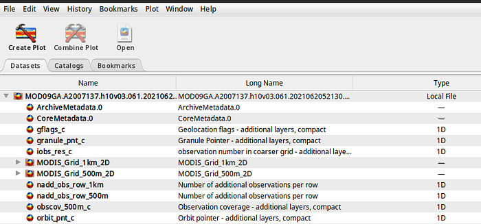
</p> <p><img alt="" src="https://miro.medium.com/v2/resize:fit:700/1*O8HY8Xmac6ywtM9spQOaPA.png" style="height:328px; width:700px" /></p> <p>Image by&nbsp;<a href="https://medium.com/@alexroz" rel="noopener">author</a>.</p> <p>If you click on one of them, you&rsquo;ll be able to see all the needy-greedy details about the dataset such data types, scale factors, resolution etc.</p> <p><a href="https://medium.com/@alexroz/no-code-no-problems-exploring-satellite-views-with-panoply-61457c9ae991"><strong>Website</strong></a></p>